CartoScène365
One map for all your teams, wherever they are.
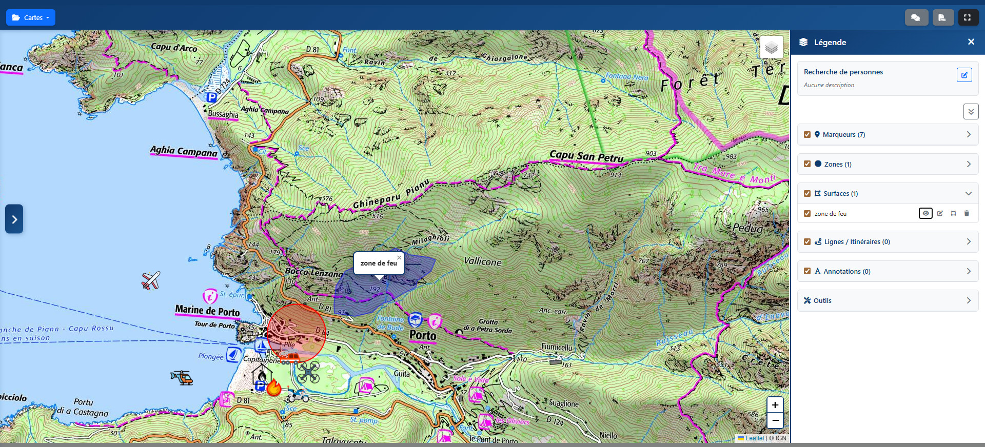
CartoScène365 lets several remote sites share and exchange geographic data in real time. It opens from a simple QR code or text message link, with nothing to install.
Who is it for?
Multi-site organisations coordinating teams spread across the field.
Available on
Web browser
No installation
Key features
Shared mapping
Every site sees and adds to the same map in real time.
QR code or text message access
No app to install, on phone, tablet or PC.
Multi-site
Data flows between remote sites, with no re-entry.
Team coordination
Ideal for managing teams spread across several locations.
In the same sector
FlyView
Real-time coordination of drone teams.
VigieDECI
Firefighting water points, tracked by the fire service and local councils.
Dispo-Web
Team availability and scheduling in real time.
Locating teams or missing persons
Remotely locate a team or a person and share their position.
SPV-Pay
Allowance tracking for volunteer firefighters.
An application like this for your organisation?
Each application can be adapted to your organisation, or serve as the basis for a custom development.
Let's talk